Optimized Flight Patterns
AI calculates the most efficient waypoint paths for complete coverage with minimal flight time and battery consumption.
From automated mission planning to court-ready 3D scene reconstruction — everything your agency needs to run a professional drone program.
Every mission is powered by integrated AI that makes automated drone operations smarter, faster, and more reliable.
AI calculates the most efficient waypoint paths for complete coverage with minimal flight time and battery consumption.
Camera angles, overlap percentages, and capture intervals are automatically tuned for photogrammetry-ready output and optimal 3D reconstruction.
From address entry to a complete, optimized waypoint flight plan — what takes hours of manual planning is done in under 90 seconds.
From address entry to a shareable 3D model, the entire process is automated.
Type an address or drop a pin. The system auto-detects the building footprint and property boundary.
Select your mission type and drone model. Integrated AI optimizes flight patterns and photo collection. A complete waypoint flight plan is generated in under 90 seconds.
Review and confirm mission speed and flight height before deployment. Adjust parameters to match conditions on the ground.
Load the mission file onto your DJI controller and execute the autonomous flight. The drone captures standardized, high-overlap imagery.
Import imagery into the desktop app. Get a complete 3D scene reconstruction in under 15 minutes. Share interactive 3D models with investigators, prosecutors, and command staff.
A Windows desktop app for mission planning and processing, and an Android companion app for field execution.
Mission planning, photogrammetry processing, 3D model generation, model sharing, fleet and license management. The command center for your drone operations.
System requirements: Windows with 16 GB RAM minimum (32 GB recommended).
Loads onto DJI RC Pro controller for real-time mission execution in the field. Review flight plans, execute autonomous missions, and monitor flight progress.
Compatible with: DJI RC Pro controller running Android.
All missions use integrated AI to optimize flight patterns and photo collection. Purpose-built templates for real-world public safety operations.
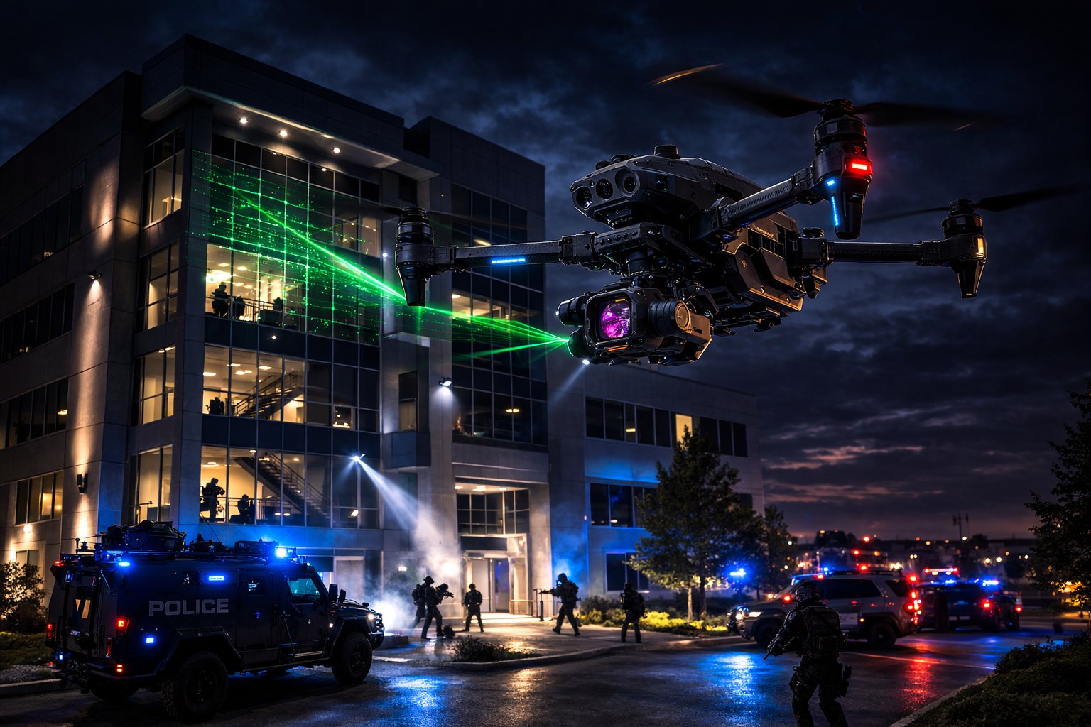
Four automated perimeter passes capture every side of a structure for tactical situational awareness. The straight pass documents facades head-on, right-oblique and left-oblique passes provide angled perspectives for depth and concealment analysis, and the nadir pass delivers a top-down overview. Purpose-built for SWAT pre-planning, barricade incidents, and critical infrastructure documentation.
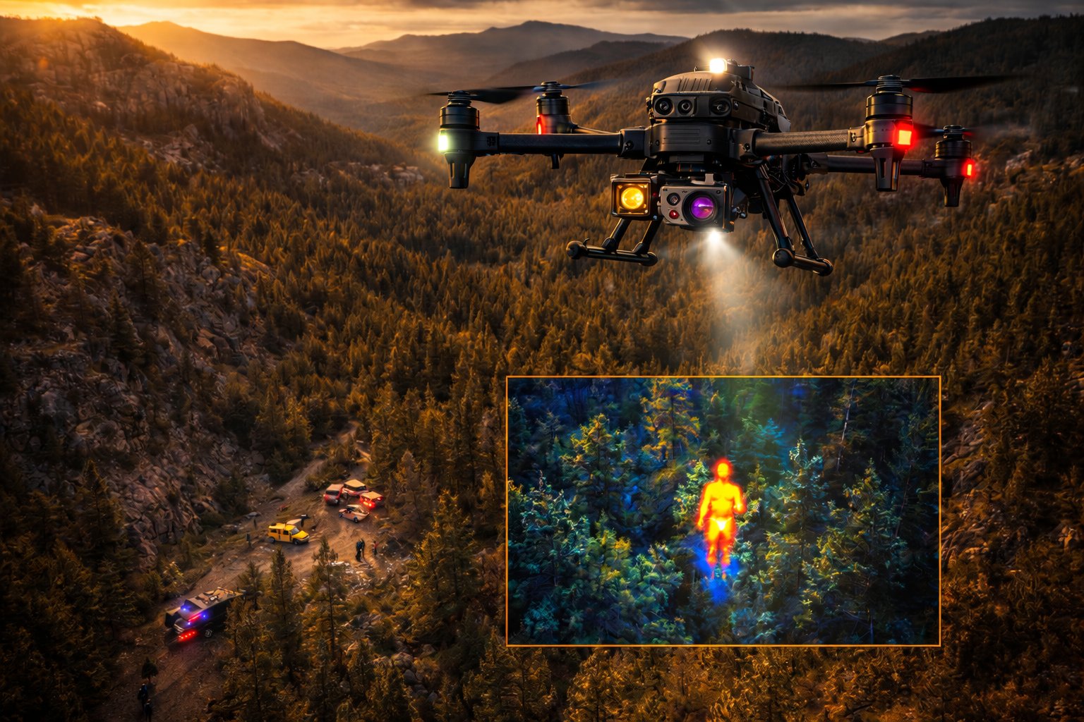
A single nadir pass over a wide-area grid enables rapid coverage of large search zones. Optimized for missing-person operations, disaster debris fields, and wilderness searches. The automated grid ensures no area is missed, while the straight-down camera angle maximizes ground visibility for both visual and thermal sensors.
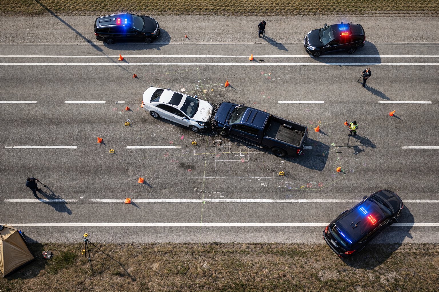
Three automated grid passes capture comprehensive overhead imagery for traffic collision reconstruction. High-overlap nadir photography produces detailed orthomosaics and 3D point clouds that preserve the scene with survey-grade accuracy. Designed to clear roadways faster while delivering courtroom-ready documentation.
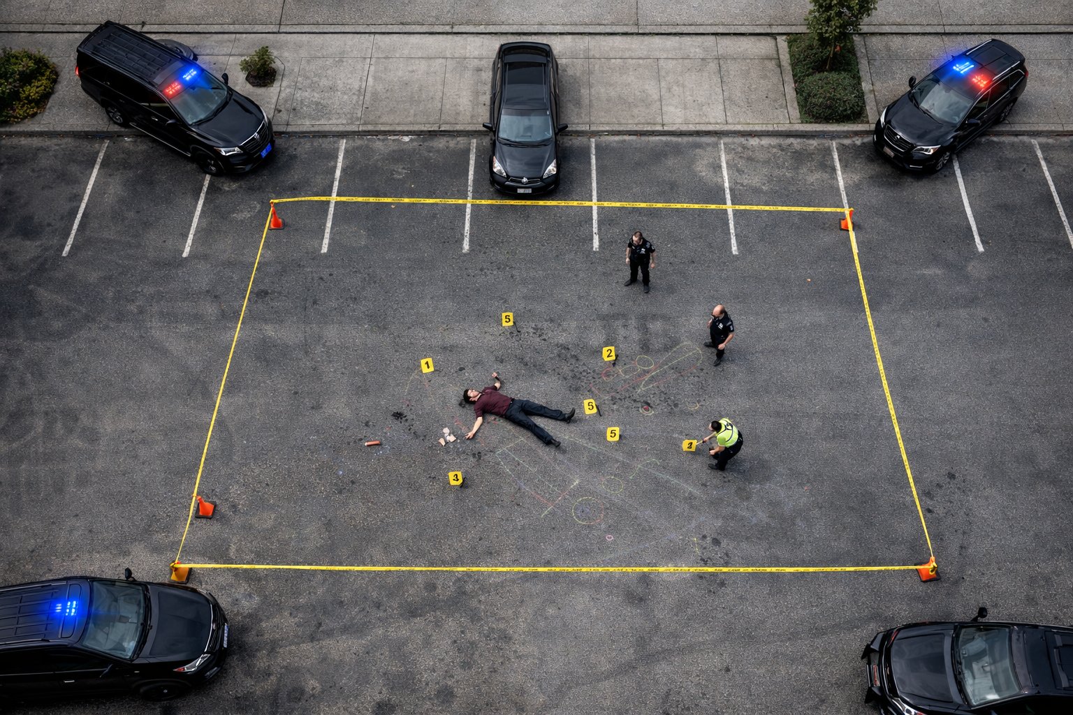
Three grid passes deliver high-resolution overhead documentation of crime scenes for forensic analysis and evidence preservation. The automated flight plan ensures consistent, repeatable coverage that stands up to legal scrutiny. Ideal for homicide scenes, officer-involved incidents, and large outdoor evidence areas.
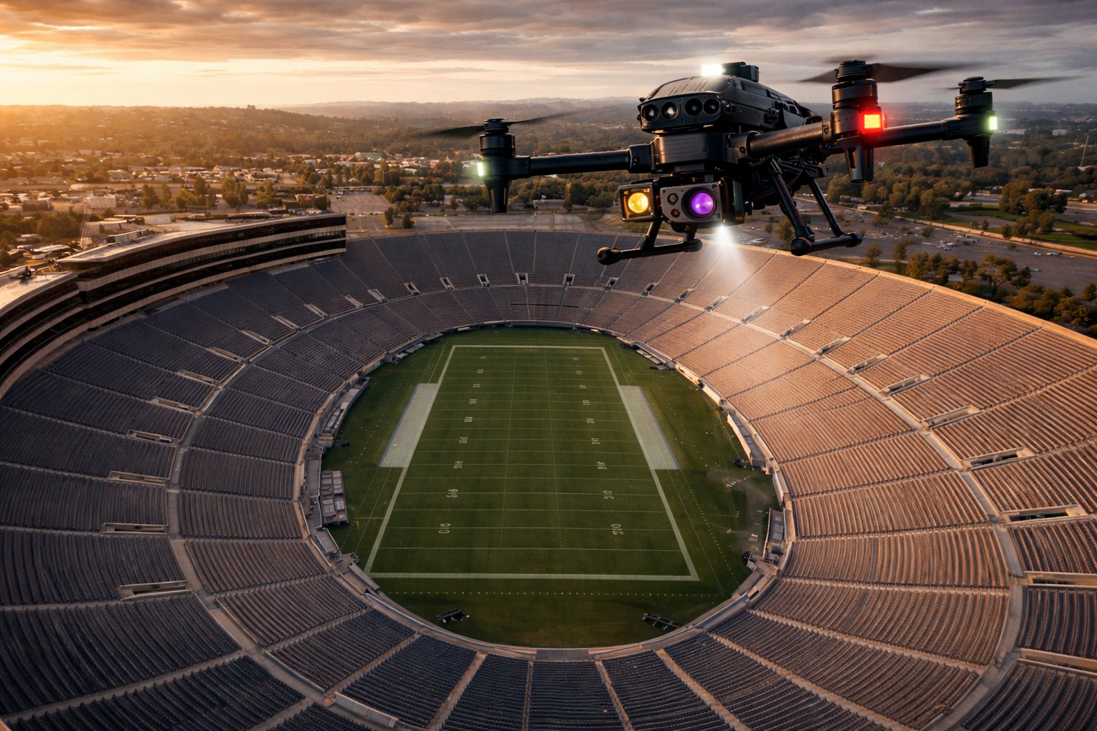
Four automated passes provide complete situational awareness of large venues and outdoor areas. Built for event security pre-planning, threat assessment, and emergency egress analysis.
Every mission type is AI engineered for optimal photogrammetry-ready output.
Built-in photogrammetry processing turns drone imagery into court-ready 3D models without leaving the app. High-overlap, multi-angle imagery feeds directly into the integrated processing pipeline to generate complete 3D scene reconstructions.
System requirements: Windows desktop or laptop with 16 GB RAM minimum (32 GB recommended).
Get interactive 3D scene reconstructions into the hands of investigators, prosecutors, and command staff with a single link.
A complete system for managing every aspect of your agency's drone program.
Manage drone missions, coordinate deployments, and support real-world incident response.
Manage pilot rosters, track certifications and flight hours, monitor drone maintenance schedules, and ensure every operator and aircraft is current and mission-ready.
Associate flights with incidents and maintain clear operational records for every deployment.
Complete audit trail from capture to courtroom. Every image, flight log, and 3D model is timestamped and traceable for evidence admissibility.
Generate PDF reports for FAA Part 107 compliance, including flight logs, pilot certifications, and waiver documentation. Always audit-ready.
Automated monthly and annual PDF reports for command staff — mission counts, flight hours, pilot activity, fleet utilization, and program ROI metrics.
Provide command staff insight into all drone deployments, pilot activity, and operational outcomes.
No hardware lock-in. Works with the DJI Enterprise drones your agency already owns.
Every mission type maps to real-world workflows across these public safety sub-sectors.