Pre-Flight Checklist
Automated checks for GPS lock, battery level, SD card capacity, and airspace authorization before every mission launch.
From a single address to a complete automated flight plan — with photogrammetry-ready imagery for 3D modeling and courtroom presentation.
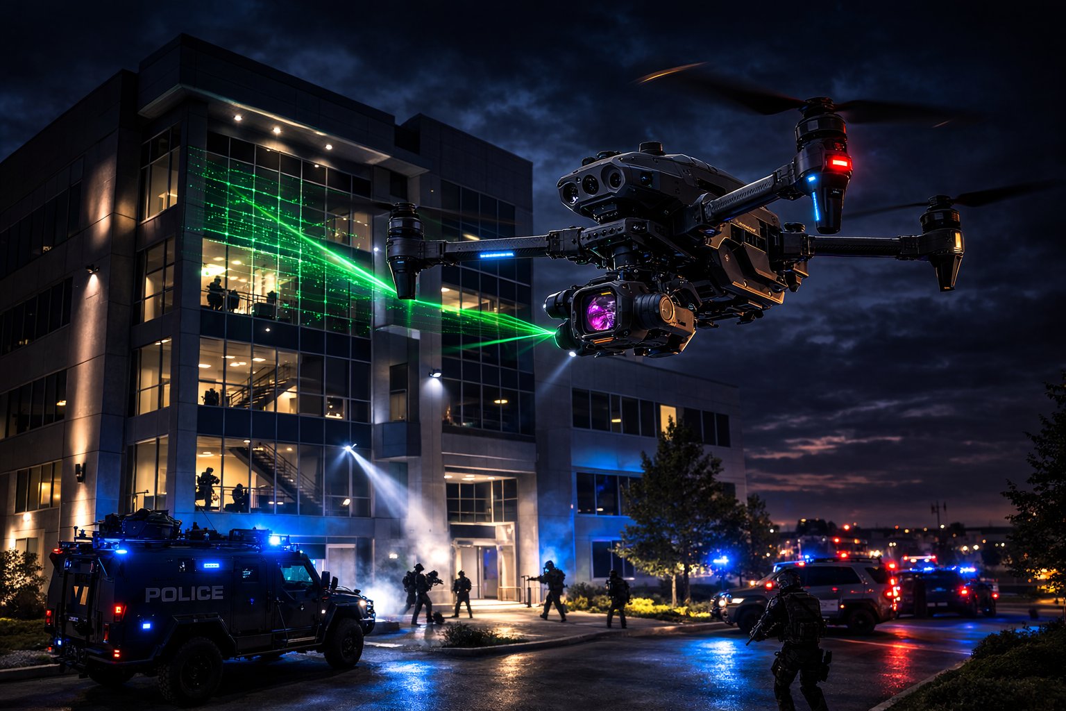
Four automated perimeter passes capture every side of a structure for tactical situational awareness. The straight pass documents facades head-on, right-oblique and left-oblique passes provide angled perspectives for depth and concealment analysis, and the nadir pass delivers a top-down overview. Purpose-built for SWAT pre-planning, barricade incidents, and critical infrastructure documentation.
 Mission Preview
A single nadir pass over a wide-area grid enables rapid coverage of large search zones. Optimized for missing-person operations, disaster debris fields, and wilderness searches. The automated grid ensures no area is missed, while the straight-down camera angle maximizes ground visibility for both visual and thermal sensors.
 Mission Preview
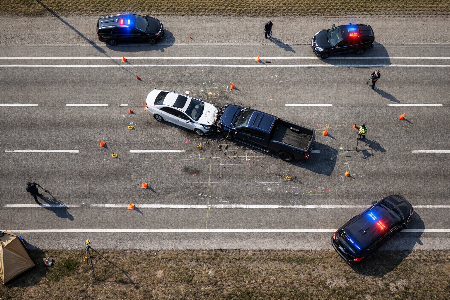
Three automated grid passes capture comprehensive overhead imagery for traffic collision reconstruction. High-overlap nadir photography produces detailed orthomosaics and 3D point clouds that preserve the scene with survey-grade accuracy. Designed to clear roadways faster while delivering courtroom-ready documentation.
 Mission Preview
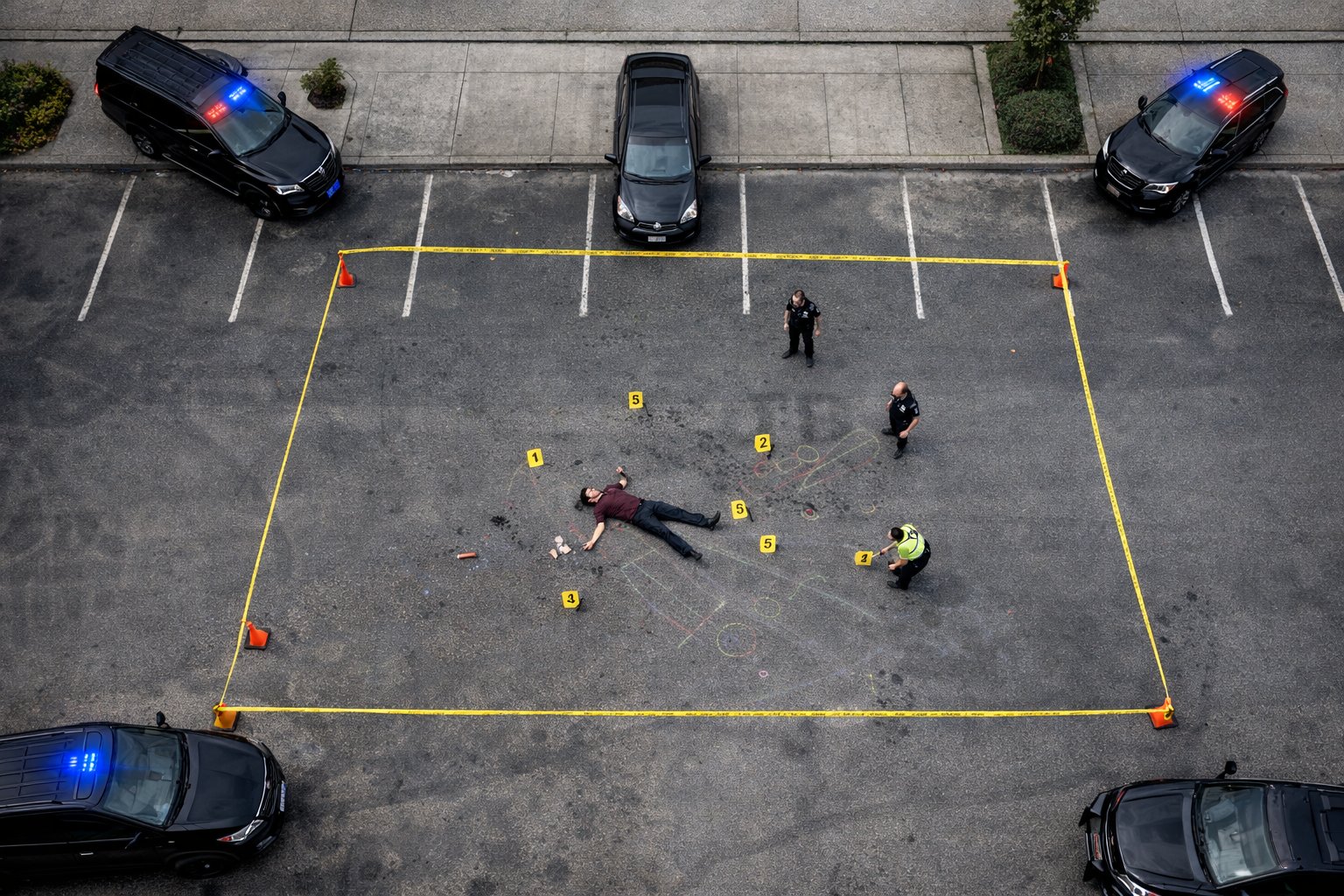
Three grid passes deliver high-resolution overhead documentation of crime scenes for forensic analysis and evidence preservation. The automated flight plan ensures consistent, repeatable coverage that stands up to legal scrutiny. Ideal for homicide scenes, officer-involved incidents, and large outdoor evidence areas.
 Mission Preview
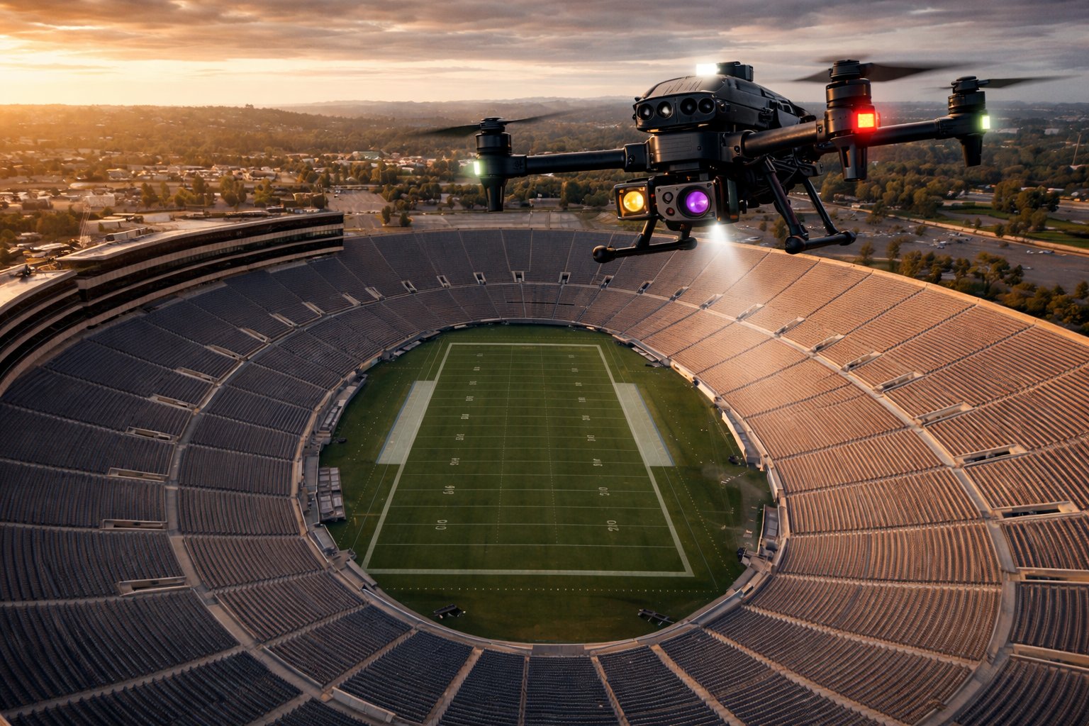
Nine automated passes provide complete situational awareness of large venues. Four exterior perimeter passes document every facade, one inward-facing pass captures entry and exit points, three overhead grid passes map the interior and seating bowl, and a final orbit ties it all together. Built for event security pre-planning, threat assessment, and emergency egress analysis.
 Mission Preview
Every mission type is engineered for photogrammetry-ready output. High-overlap, multi-angle imagery feeds directly into industry-standard processing software to generate 3D point clouds, orthomosaics, digital elevation models, and textured mesh reconstructions. Accident investigators get survey-grade scene models. Crime scene units get measurable 3D evidence. Tactical teams get full-structure models for pre-planning. All courtroom-ready, all from a single automated flight.
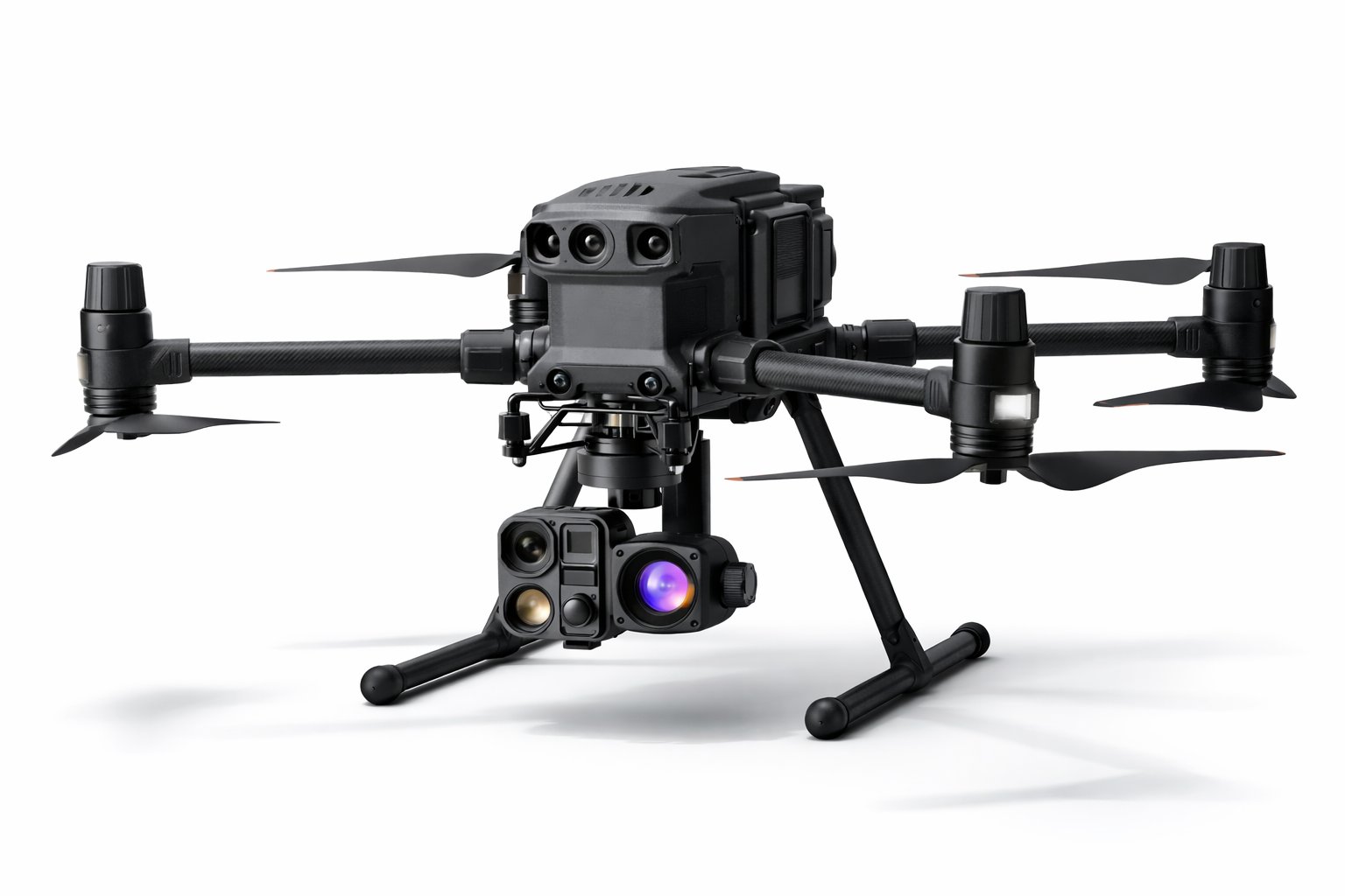
Compatible with DJI Enterprise drone platforms using the WPML 1.0.6 waypoint protocol.
Every feature designed for real-world drone operations, from pre-flight to post-processing.
Automated checks for GPS lock, battery level, SD card capacity, and airspace authorization before every mission launch.
Automatic photo EXIF tagging with property address metadata. Every image is traceable to its mission location and timestamp.
Upload mission imagery to S3 cloud storage with 8 concurrent connections. Get your data off the drone and into processing faster.
Generate professional PDF reports with flight path maps, mission parameters, photo counts, and timestamps for client delivery.
Complete searchable log of every mission flown. Review past flights, re-download mission files, and track team productivity.
Resume interrupted missions from the last completed waypoint. Battery swap or signal loss does not mean starting over from scratch.
All missions capture high-overlap, multi-angle imagery optimized for 3D point clouds, orthomosaics, and textured mesh models in any photogrammetry software.
Every mission type maps to real-world workflows across these public safety sub-sectors.
From address entry to mission download in under 30 seconds.